Cabo Rojo (Cabo Rojo Municipio)
 |
 |
The area near Las Salinas (salt flats) has been inhabited since 30 BC and AD 120 according to archaeological evidence. Punta Ostiones, listed in the National Register of Historic Places as an archeological site, was home to a large group of Archaic Indians.
Despite the threat of pirates and natives, the Spanish settled the area of Los Morrillos around 1511. By 1525, salt mining was an important industry in the area. In 1759 the first request to establish itself as a town was denied. Cabo Rojo was founded on December 17, 1771, by Nicolás Ramírez de Arellano, a descendant of Spanish royalty and nobility, with the approval of Governor and Captain General Miguel de Muesas. According to Fray Iñigo Abbad y Lasierra by the end of the 18th century, Cabo Rojo had a population of 1,215 people.
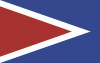
Cabo Rojo (red cape in English) derives its name from both the reddish color of its salt-flats and the reddish tint that characterizes the seaside cliffs along its southern coast. According to legend, the name was given by Christopher Columbus himself. The first church, founded in 1783, was called San José. The present-day main Catholic church is called San Miguel Arcángel Church located in the town's square.
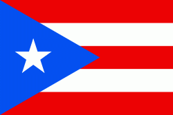
Puerto Rico was ceded by Spain in the aftermath of the Spanish–American War under the terms of the Treaty of Paris of 1898 and became an unincorporated territory of the United States. On October 18, 1898, formal possession of the island was assumed and the American flag raised over the fortifications from which the emblem of Spain had flown for nearly four centuries.
Hurricane Maria struck Puerto Rico on September 20, 2017, causing large-scale damage and destruction to infrastructure. In Cabo Rojo, around 400 homes lost their roof, and three thousand residents were left without drinking water as a result of Hurricane María. The coastal fishing village of Joyuda was the most impacted area of Cabo Rojo.
Map - Cabo Rojo (Cabo Rojo Municipio)
Map


Country - Puerto Rico
 |
 |
Currency / Language
| ISO | Currency | Symbol | Significant figures |
|---|---|---|---|
| USD | United States dollar | $ | 2 |
| ISO | Language |
|---|---|
| EN | English language |
| ES | Spanish language |